While technically true, that delineation has proven to be a political one. The previous liberal government redefined that district as southern Ontario, a move which was eventually reversed by the current PCs in part to afford the benefits of being a part of “Northern Ontario” to a PC stronghold that has been strongly contested by the greens in the past few elections. IMO theres more to it than just how the government defines it.
On the one hand, the government (specifically the MTO, the only ministry that cared at the time) has been using the “southern border of Parry Sound district” definition for at least 35 years. It was on the forms when I applied for my first driver’s license, if I recall correctly.
On the other hand, I don’t claim that “Parry Sound district” necessarily covers the same geographical location now that it did back then.
On the third hand, if I were drawing an “I think this is northern Ontario” line, it would be at about the latitude of North Bay, but that’s just my opinion and has no authority. At least the government definition is official.
On the fourth hand, I think I’ve visited the actual town of Parry Sound for all of one hour thirty-odd years ago, so I can’t speak to its demographics or culture. We’ve almost never had any reason to detour that far from the straight shot down to Toronto along Hwy. 11.


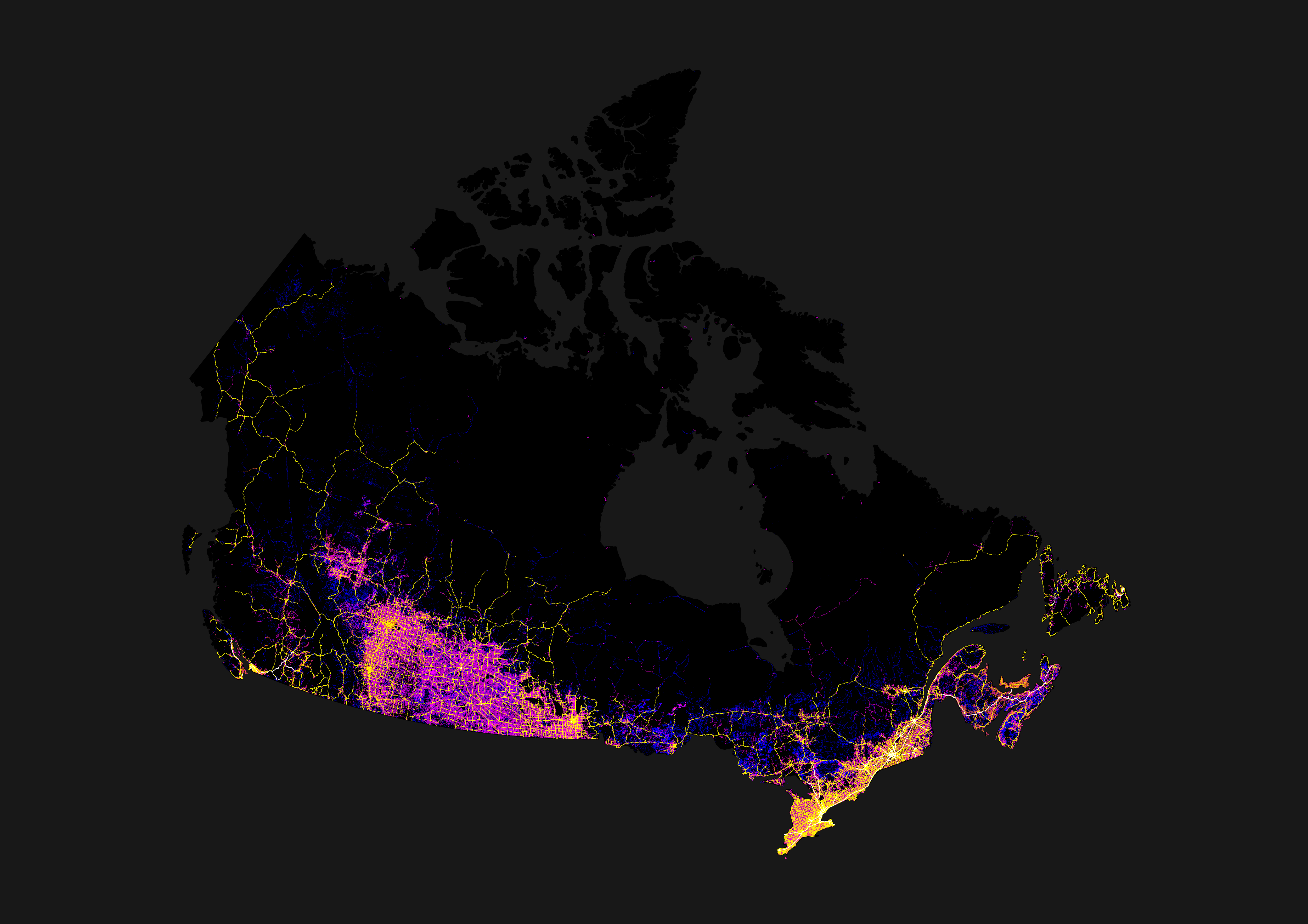
The actual border, per government definition, is the southern edge of the Parry Sound district. Which is north of Orillia.
While technically true, that delineation has proven to be a political one. The previous liberal government redefined that district as southern Ontario, a move which was eventually reversed by the current PCs in part to afford the benefits of being a part of “Northern Ontario” to a PC stronghold that has been strongly contested by the greens in the past few elections. IMO theres more to it than just how the government defines it.
On the one hand, the government (specifically the MTO, the only ministry that cared at the time) has been using the “southern border of Parry Sound district” definition for at least 35 years. It was on the forms when I applied for my first driver’s license, if I recall correctly.
On the other hand, I don’t claim that “Parry Sound district” necessarily covers the same geographical location now that it did back then.
On the third hand, if I were drawing an “I think this is northern Ontario” line, it would be at about the latitude of North Bay, but that’s just my opinion and has no authority. At least the government definition is official.
On the fourth hand, I think I’ve visited the actual town of Parry Sound for all of one hour thirty-odd years ago, so I can’t speak to its demographics or culture. We’ve almost never had any reason to detour that far from the straight shot down to Toronto along Hwy. 11.